Wednesday 31 August 2011

Moorhen tracks

I don't know what the moorhen was walking in before it got on our roof, but it certainly left some very clear tracks behind showing where it had been.  Travelled to Compton today in brighter weather, passing this bridge over a locktail, where use of tow ropes over the years had almost cut through one post of the bridge.

Tuesday 30 August 2011

Wolverley Court to Rocky Lock

Todays route was a narrow, shallow channel that wound its way between sandstone outcrops and through attractive woodland.  We witnessed an impromtu stoppage while having lunch on the terrace of The Vine in Kinver - three BW vehicles arrived and in short order had assembled a working platform, put in stop planks, and descended into the canal bed above the lock to rectify a problem with the paddles.
  Within an hour or two, all was complete and the queues that had started to build up had dissipated.

Monday 29 August 2011

Droitwich to Wolverley Court

A long day's travelling, what with the Bank Holiday queues, from the canal up the Severn to Stourport and then on through Kidderminster.  The Barge Canal has thickly reeded banks that make mooring impossible anywhere other than at lock landings and in the town.  Dropping through the locks we met several groups who said they hadn't known this, and had no option but to moor at the locks.  Other boats were still moored on lock landings, which would make things difficult for single handed boaters making an early start.  Also worth noting that the moorings in the Basin are limited to 48 hours, although I doubt many would want to stay longer as there are no services on the canal.

The Severn is always impressive, but it is difficult to capture that in a photograph.

Quite a queue built up at Stourport as the boat ahead of us had waited for a small cruiser to descend both pairs of staircase locks.  We were soon on the move though, and eventually stopped just above Wolverley Court lock.


Sunday 28 August 2011

Droitwich Barge Canal

After deciding that an early start would be a good idea in case the moorings in Droitwich Netherwich Basin were in demand, we slept in a bit late as it was so quiet in Worcester.  We were last to leave the visitor moorings, and after taking a while to fill with water and wait for other boats at the locks, it was mid-morning before we were down on the Severn.  After one lock on the Severn, we got to the start of the newly reopened Barge Canal.
It is a very pretty and mostly rural trip, although the locks are quite heavy and slow to empty and fill.  There is still plenty of room on the moorings, and lots of boaters around discussing what clearance they had coming under the M5, or what damage they did to their boats.  One worrying tale was from someone who had cleared the gauge, yet still had damage and got temporarily stuck,  perhaps because of someone turning the lock above the bridge.  You can't see if there is anyone in the tunnel from the lock, so it seems quite possible.  The moorings in the basin seem very tranquil, apart from the odd train clanking past.

Saturday 27 August 2011

Hanbury to Diglis Basin

The first boat on the moorings at Hanbury is looking very heavily fendered - probably has to do with the fact that the line of the canal after the bridge takes a turn to the right.  Looks like what was probably a nice quiet mooring may have been transformed by the newly restored canal into a less agreeable location.  Further down there is a lot of weed growing in the channel.  Fortunately traffic was reasonably light, so we didn't meet anyone in the narrows.
We were first onto the visitor moorings in Diglis Basin, but they're full now, and the waterpoints are filling up with the late arrivals.

Friday 26 August 2011

Hanbury Wharf

 Just after we got in from dinner last night the heavens opened for the first of a series of showers through the night.  Soon after we set off we had another shower from about 9:15 to 13:15.  It wasn't always heavy though, sometimes lifting enough to give views of Worcester in the distance.

We moored up for lunch then walked into Droitwich and back on the newly opened canal, to take a look at the culvert under the M5 which almost certainly doesn't have enough headroom for Caracol.  

Thursday 25 August 2011

Leaves on the line

After yesterday's adventures, on seeing evidence of a lump of a tree in the water, I took due care.  You have to guess which side of the visible lump to pass, and I guessed wrong - I thought it had fallen in from the offside at a distance, but having passed it it looks like it was ripped from a tree on the towpath.
 
Just around the corner was this spectacular piece of artwork - a kind of camouflage for mooring in the countryside, with all sorts of flaura and fauna making a showing in what seemed to be a hand painted piece.

In every tunnel this trip I've seen something flying, and apparently feeding on insects.  The flight looked more like a House Martin rather than a bat, but finally today I saw where they landed after picking up some choice morsels from around the headlight beam.
The rest of the day saw us descending the Tardebigge flight.  So much easier in sunny weather unlike the last trip, with lots of traffic the other way, so no need to turn locks.  Given the weather forecast, I had it in mind to title this post "Why does it always rain on me?", but that seems superfluous now.

Wednesday 24 August 2011

The route into Birmingham is surprisingly leafy and pleasant with the bright sunshine giving dappled patterns on the water.  One unusual sight was a dam put in place to hold back the water so that work could be carried out on one of the spill ways.  It seemed surprisingly flimsy to hold back so much weight.

Then it was time for a couple of surprises.  The first was a crowd of the local youth near Kingswood Junction, calling abuse from the safety of the tree line, and dropping berries on the boat from a pipe bridge that a couple had crawled onto.  They seemed upset that despite trying a variety of insults they could stimulate no more response than a laugh from us. 

The second surprise came when passing through the remains of the stop lock at King's Norton, where our boat came to a sudden halt and wouldn't budge.  Exploration with a boat pole revealed what felt like a log wedging us firmly in.  Pushing and pulling and hitting the log did nothing to dislodge it.  Fortunately a following boat had a scaffolding pole, and after various attempts what shifted us was tying the boats together, both engines in reverse, pulling from the bank, and levering up the bow of the boat with the scaffold pole.  What had stopped us was a portion of tree about three feet long and having the stumps of several branches.
 
We moored for the night at Hopwood, which had a little traffic noise that we thought would die down over the evening.  Unfortunately there were major road works scheduled, and lots of big machines going up and down the road until very late.  It is the reversing alarms that are hardest to ignore...

Tuesday 23 August 2011

Hockley Heath

Setting off from Hatton, the levels were low again needing a little care to stay in the channel to make progress.  One unusual sight was a hay bale, plastic wrapped, that had rolled, or had been rolled, down the hill to rest in the shallows of the canal.

Lapworth arrived in time for lunch at the Boot, which was not up to the same standard as usual.  We went up the Lapworth flight in bright sun and high temperatures, before deciding to stop for the night at Hockley Heath, simply because we hadn't done so before.  It always looks very pretty from the back of a boat, where the noise of your engine hides the traffic noise from vehicles crossing the bridge.  It had calmed down a lot a little bit later on.


Monday 22 August 2011

Warwick and Hatton

A cool autumnal morning saw us setting off for the retail opportunities of Leamington and Hatton. The bottom pound had filled by about four inches overnight from the pump operating at the lock, presumably raising the level of the whole flight.  Once through the lock there was no sign of water shortage.   With the larder fully stocked we set off up Hatton, and were lucky enough to pick up a partner after the first lock.  It was a slow trip so we stopped for the night just above the locks.

Sunday 21 August 2011

To Radford

A familiar trip down to Radford on low pounds.  The early morning light was beautiful and had that yellowish tinge that often precedes rain.   However, the translucent clouds thinned rather than thickening, and soon we were under bright sunshine.  It was too warm to sit and eat outside the Two Boats, so we retreated back to the boat.  The mooring above Radford Lock was unusually quiet.
One thing that I'd forgotten about, boating at this time of year, is spiders.  We tend to be fairly tolerant of them on the boat, after all they spend more time aboard than we do, and do a useful job keeping the insect numbers down.  This time of year though, they are just too numerous.  When I pushed the hatch forward this morning I thought I'd dislodged some drops of water from the overnight rain.  I soon spotted though that what hit my head and shoulders were spiders, startled by the sudden movement and abseiling down to what might be safety.  There was a particularly large one that had taken residence in the hole in the tiller, and came out at speed as I dropped the tiller pin in place.  In the early evening you can see them emerging from somewhere to spin their hopeful webs across the tops of the windows.  There are too many, and there will be evictions.

Saturday 20 August 2011

Holiday time at last

It has been a long time coming but we're finally ready to set off on our summer trip.  This year we decided to have three weeks together instead of two so that we could reach more distant parts of the system.  We had the Kennet and Avon Canal in mind, thinking three weeks could get us as far as Devizes.  As the time got closer, more and more bad news arrived about water shortages.  Firstly the locks up to the Oxford Canal summit were limited to nine am to four pm, then it was down to 10 am to two pm, with BW staff around to encourage you to wait for a boat coming the other way for up to an hour if the lock was in their favour.  So that had us thinking about alternatives.  Then the riots, and their impact on boaters in cities added a further complication about which way we'd go based on where we'd be happy to moor if that recurred.

Other time restrictions and stoppages have been added, meaning slow passage on the North Oxford through Hilmorton, and the Leicester Arm seems particularly bad.  So in the end we seem to have decided not to decide, just head north on the Grand Union and play it by ear.  One idea is to go down towards Worcester and see the newly reopened Droitwich Canal then round to the north of Birmingham, depending on what else is in the news by the time we get there.  Someone mentioned to me Chris Clegg's Canal Map, which on one  side of A4 maps the system in two hour increments, and on the other side shows how far you are likely to get in 6, 8, or 10 hour days of cruising. Having said that I think we must cruise a bit slower than some as we only seemed to do what the map suggests is a six hour trip in some of our 8-10 hour days last year on the Thames Ring.  That should make looking at the options a bit easier as we travel.  

What with one thing and another we've lost a day as some last minute work things got in the way of travelling yesterday, and we had a particularly slow trip today.  Still, here we are, boat filled with fuel and water, weedhatch checked, and ready to go in the morning.

Saturday 6 August 2011

OpenStreetMap and Garmin

I first saw OpenStreetMap a few years ago, with its mission to create a free editable map of the world, but thought it looked rather hard work.  So I carried on buying things like Ordnance Survey topographical mapping when I got a new Garmin Legend a few years ago.  The road mapping and routing were fine, but things like footpaths were only patchily covered, and sometimes had missing parts.  Also, the mapping cost about as much as the device to use it on, and you could only view it on the handheld and not in the "Mapsource" programme that Garmin supply.
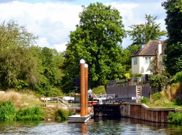
View Larger Map
Either I missed the plot last time I looked, or OpenStreetMap has got dramatically more useful and easier.  Taking this view of the area around Gas Street Basin as an example, there is lots more detail there than on the OS 1:25000 maps on footways and access to roads at bridges, as well as identification of shops and restaurants, useful for visitors.  Unlike the OS based products, paths can be made routable, so the routing capability on the handheld will take you onto towpaths when that is more direct, rather than using only the roads.

It is also free for anyone to use, and various enthusiasts have made available downloadable versions that can be put on a data card and used in many GPS devices.  If there isn't one there to suit your needs, there are also instructions elsewhere on that wiki on how to build your own maps with particular emphasis on the features you want to see.  As an aside you can also download Points of Interest on a planned route on Canalplan and load these via Mapsource, so that you have all bridges, locks and moorings marked.

Of course, with anything produced this way there might be inaccuracies, missing bits, or things that are out of date.  There were certainly a couple of missing footpaths near my home, and in the woods where I walk the dog the paths had changed quite a bit in the couple of years since someone entered them, due to forestry work.  The beauty of it is though that I could correct the online map for these features in a couple of hours, and those changes propagated into the downloadable compiled versions within a couple of weeks.  I'll be looking at how complete the mapping is in some other areas during our next trip out in a couple of weeks.

I have no connection with the site other than as a grateful user, and now as an occasional contributor.