
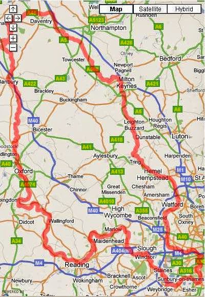
 While we were out cruising in June I left a GPS switched on to log our progress. Having finally got around to looking at it, I saw there are tools around for displaying tracks in Google Maps as an interactive window so that you can zoom in and look at the satellite images with the track in place. I can see how to do it on a website, but I can't work out how to get it into a blogger post. So paraphrasing what my ISP's mail server used to say with bad email addresses: I've tried this several times and I'm giving up now; it didn't work out; sorry. Any advice from more competent readers is most welcome.
 On another note, although GPS in itself isn't that consistent and accurate at measuring altitude, the profile from the data at least gives a sense of the climb up Napton flight, fall down the Oxford and Thames, and the climb to get back to the heart of the system. I fancy I can see the long pound after the Hanwell flight as the first shoulder after the dip in the middle, but maybe I am imagining it. As you can see from the scale, the variation in height is pretty trivial compared to distance, only about 200 locks!
 You'll have realised, I'm sure, that since this is posted at the time when most weekends would find us on the M1 heading north for the weekend that other priorities have us preoccupied for the moment.
No comments:
Post a Comment